The Gertrude Saddle Route ranks among the most stunning and rewarding hikes in Fiordland National Park, though it should not be taken lightly. This advanced tramping route leads hikers up to Gertrude Saddle, a high alpine pass that offers breathtaking views across the Gulliver Valley and out to Milford Sound.
The route begins by leading you through the Gertrude Valley, just off the Milford Sound Highway (SH94). The first section is relatively gentle, although it does involve several stream crossings, so be prepared to remove your footwear where necessary. It weaves through grassland and rocky riverbeds, following the Gertrude Stream. Orange flags indicate the route, although you’ll need to use your best judgment on where to cross at times.
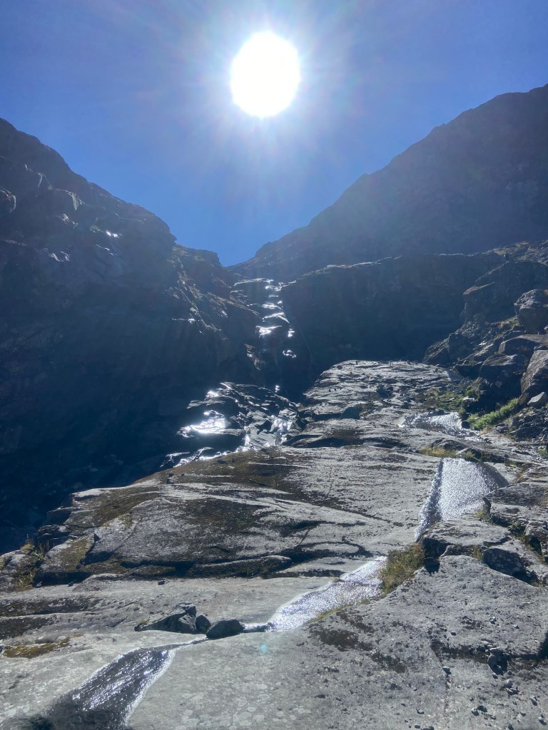
Upon reaching the head of the valley, the route steepens and becomes more demanding. It leads you up steep slopes, following the rocky switchbacks alongside a waterfall before reaching the exposed slabs.
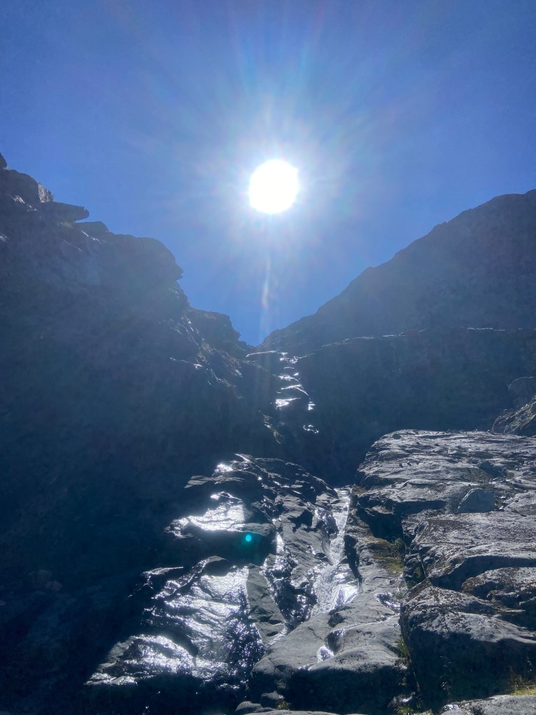
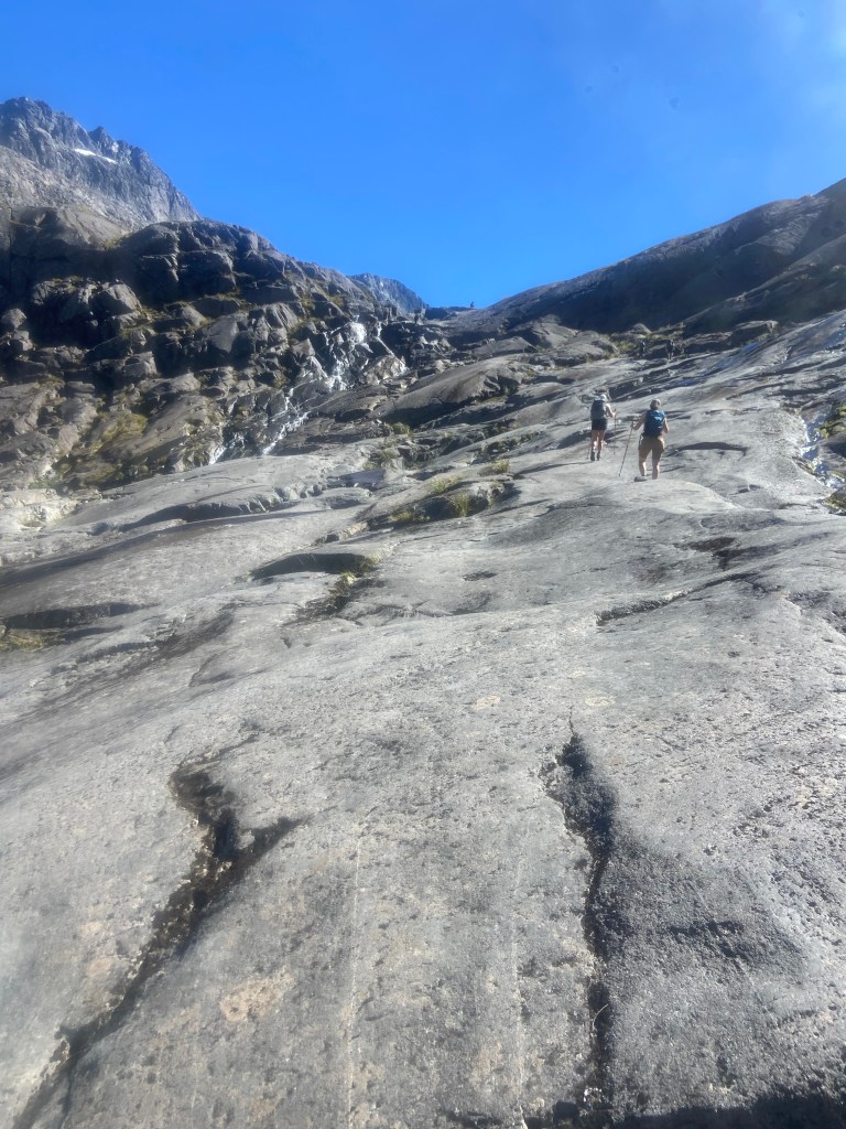
On the way up, there are several warning signs indicating that this route should be avoided in wet weather conditions. In this section, it’s clear to see why, as it involves navigating your way across exposed slabs that become extremely slippery when wet. While some sections had fixed steel cables to assist you, many parts do not, so you’ll have to trust your footwear on this one.
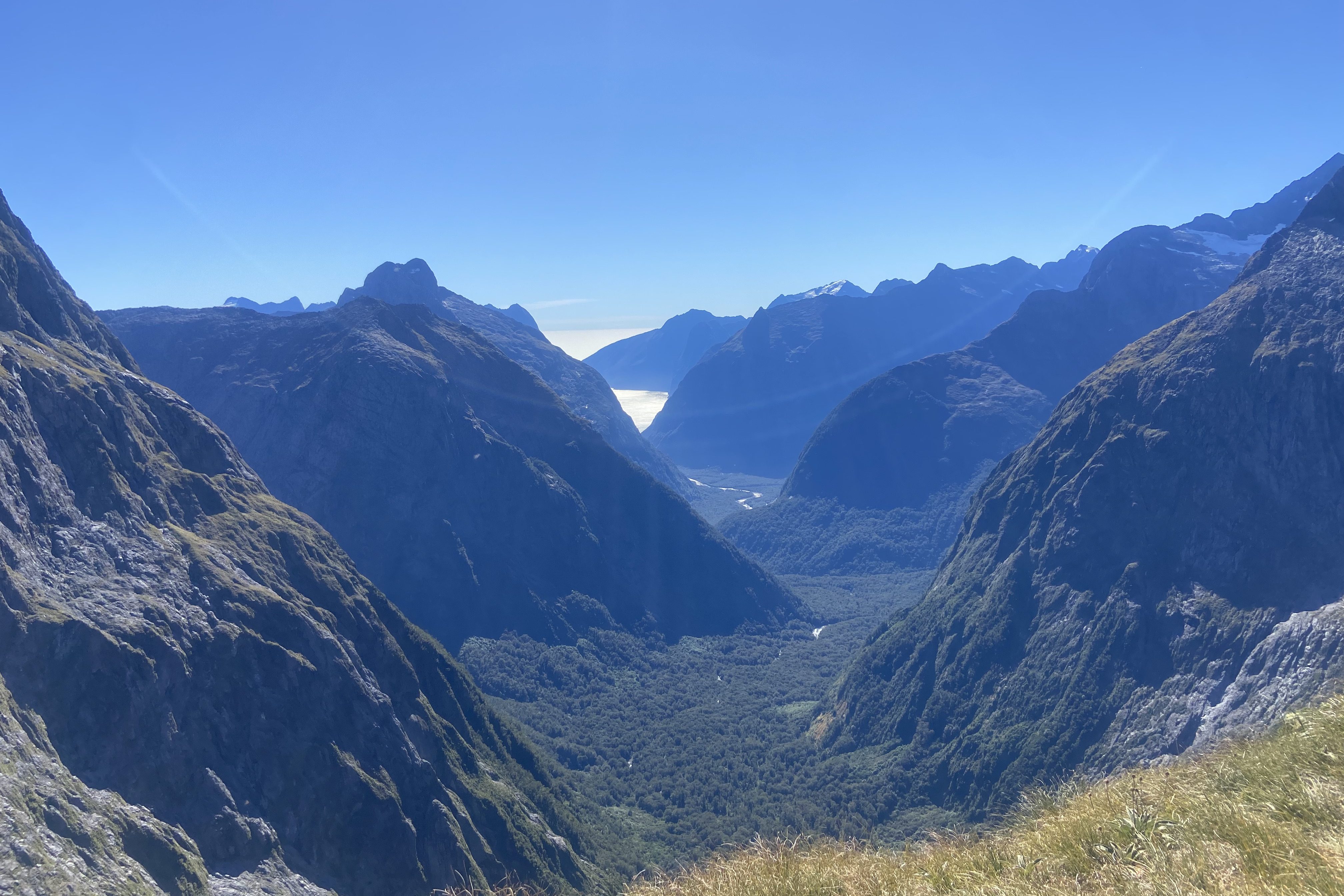
You’ll pass picturesque tarns, inviting you to take a dip to cool off before continuing up to the slabs and boulder field to reach Gertrude Saddle. Here, you’re rewarded with the stunning views all the way to Milford Sound in the distance.
The climb is about 8.4 kilometres return and is best suited for experienced hikers who are comfortable with heights and exposed terrain.
I knew before setting off that this route would likely involve some parts that would challenge my comfort level and trust in my footwear. I’d also read that this route should be avoided when wet or even when there’s a chance of rain (which absolutely made sense once I reached the slabs). However, it couldn’t have been a better day for it, and I knew I’d regret not attempting it. I was extremely lucky with the clear blue skies on the day I went. As always, since it was an out-and-back route, I gave myself permission to turn back at any point it began to feel unsafe. I still had to make it back, after all.
The initial part of the trail leads through the valley, where you have to keep a close eye out for the orange route markers that give a rough indication of where to go. There were a couple of points where it was a bit tricky to find my way across the ice-cold streams.
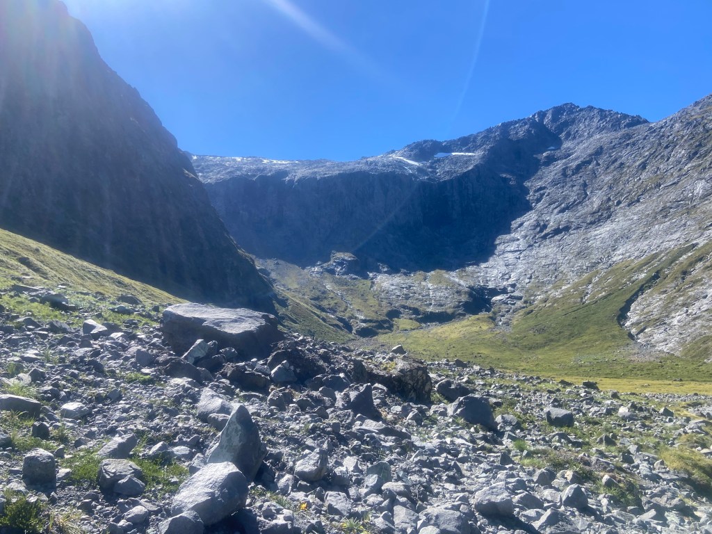
While I took my boots off for the first two or three crossings, the latter ones had some helpful hopping rocks. Once the ascent began, the path became clearer as it climbed the slope, starting with muddier sections and then rising into a long, steep climb alongside a waterfall.
This part involves navigating loose rocks and scree, which, though challenging on the way up, might be more difficult on the descent, as one passing hiker was only too happy to point out. While I was slowly melting in the sun and my fitness was being tested, he pranced by with hiking sticks and cheerfully assured me it was harder going down. Lovely. He did, however, share a good tip: to continue past the saddle to another viewpoint. I didn’t take his advice. The saddle already pushed my vertigo to the edge, and I wanted to make it back across the slabs while the sunlight was still drying any dampness the shadows might bring.
After the steep ascending switchback came the slabby section. This was the part I had been uncertain about. I took it one step at a time, steering clear of any wet areas as I didn’t particularly want to slide down the mountainside. Some subsequent sections required using a cable for stability, which was especially necessary for the descent. After this section, you’ll arrive at a magical spot beside a mountain lake. Here, I joined many others basking on the slabs and even took a dip in the freezing water.
I spent some time contemplating whether to continue up to the saddle. The route climbs further up the slabs and continues parallel along them (there’s a cable to assist, though it’s not always necessary), then traverses a boulder field to reach Gertrude Saddle, where you are rewarded for the heart-pounding effort with breathtaking views across Milford Sound.
After snapping a few photos, I began the return journey, whispering “I trust these boots” as I took tiny steps down the giant slabs. Relief washed over me once I successfully navigated the tricky sections. All that remained was the long descent and a serene walk through the valley to return to the van, where I downed a refreshing soda before driving back to my campsite.
