Located in the heart of the Cairngorms National Park, Cairn Gorm and Ben Macdui are among Scotland’s highest Munros. Cairn Gorm rises to 1,244 metres, making it the sixth highest peak in Scotland, while Ben Macdui, situated nearby, reaches a height of 1,309 metres, earning it the title of the second-highest peak in both Scotland and the UK.
The approximately 18-kilometre trail I did last winter combined these two peaks, visiting Cairn Gorm first, then continuing along the mountain slopes to visit Ben Macdui.
If doing this route in winter (as I did), be aware that it also involves a cobblestone path to the first summit, a boulderfield to reach Ben Macdui, and a stone path leading across various streams on the way down. I say all this because these rocks can get very slippery. I was grateful to have my hiking poles for extra stability for many of these sections, and I definitely slipped a couple of times on the rocky path coming down. This can also affect how long it takes to complete the route in wintery conditions.
I set out early in the morning, before sunrise. Having hiked Bynack More the day before, I had already familiarised myself with the shuttle bus from Aviemore railway station to the Coire Cas car park by the base station, which runs every hour or so. I got the first shuttle of the day, which meant starting the hike in the dark, hoping to reach the first summit by sunrise.
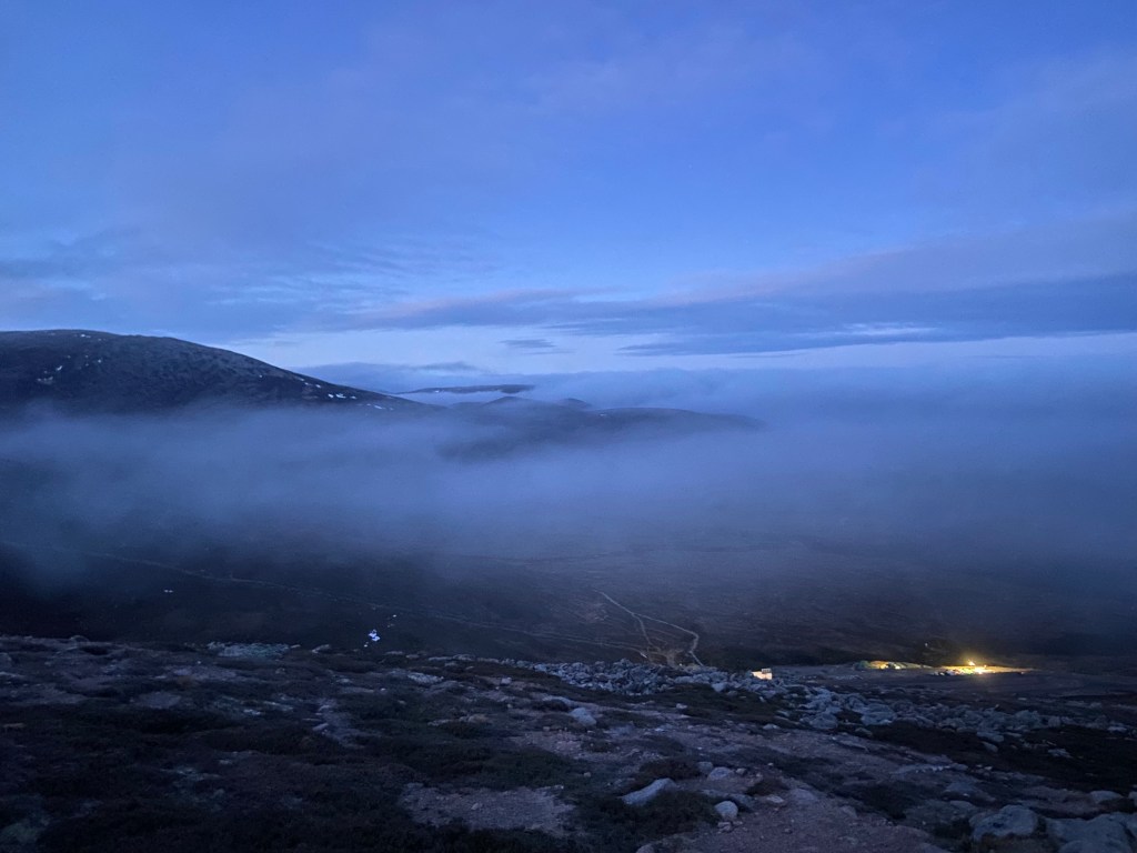
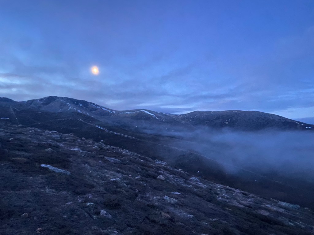
With my beanie and gloves on and headlamp at the ready, I hopped off the bus to begin the trek via the Windy Ridge Path, which leads up to Ptarmigan Station. From here, I continued on the Cairn Gorm Summit Path. With only a thin layer of frost on the cobblestone path, I followed it easily up the mountain slope. It’s a clear and well-maintained path to the summit, with a comfortable gradient. However, as already mentioned, the thin layer of frost made the path a little more slippery than it might have been once the sun hit it. With an almost full moon, the torchlight was barely necessary, and soon, the sky began to lighten, beautifully framing the surrounding mountains with much of the lower landscape obscured by low-hanging clouds
I reached the summit of Cairn Gorm after about 1 hour and 20 minutes, with the sun having risen somewhere behind the clouds.
The path descends the moorland slope and continues along the rocky edge, which overlooks Coire an t-Sneachda, before traversing Stob Coire an t-Sneachda and then veering south along the slopes of Cairn Lochan.
On this January day, there were still patches of snow covering parts of the path before reaching the bealach between Cairn Lochan and Ben Macdui. Soon after this section, it was time to navigate the bouldery terrain in order to reach the summit. The icy conditions added an extra factor to be careful of, so I took my time, following the poles that indicated the direction.
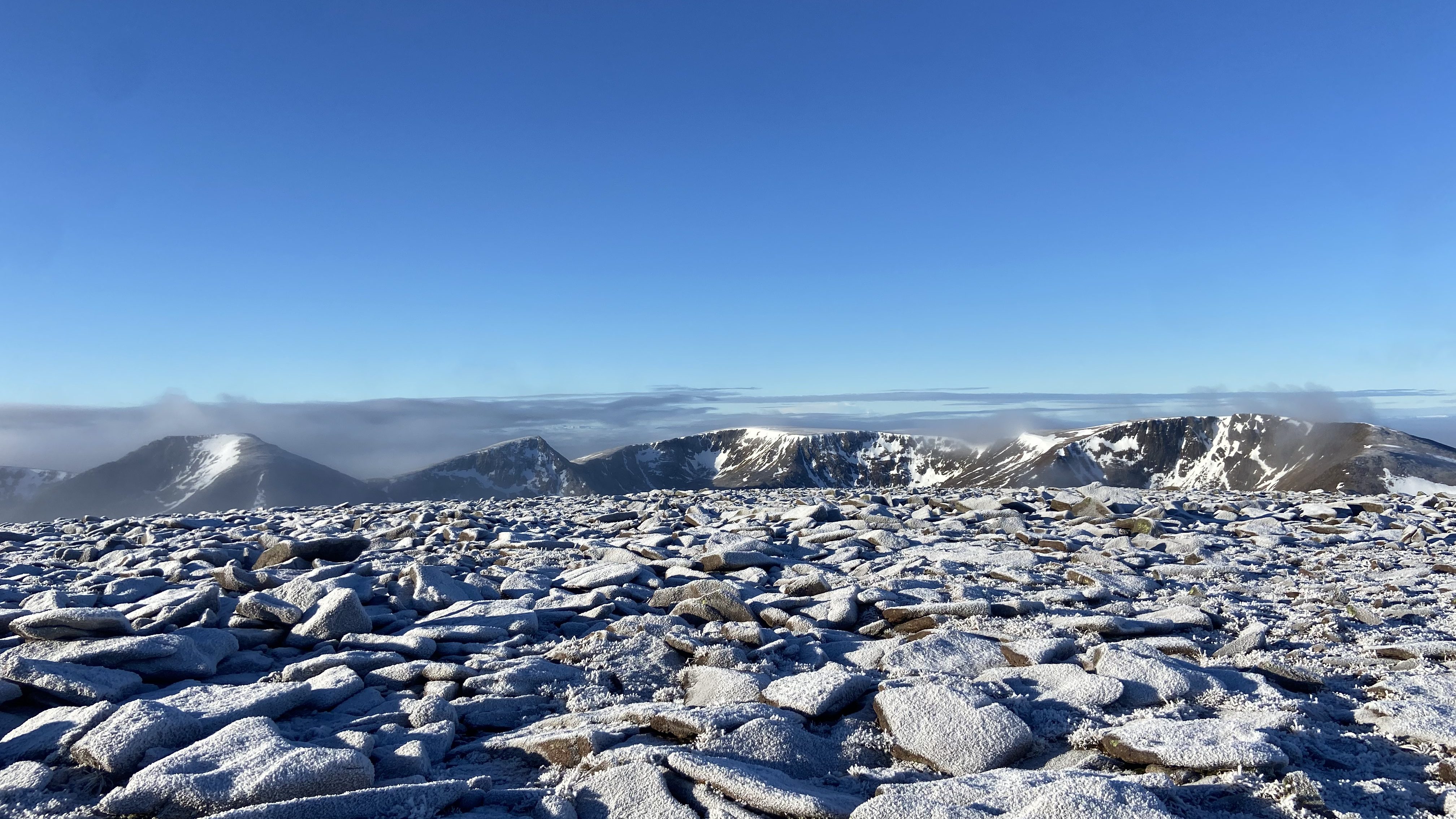
It took me roughly 3½ hours (almost 10 kilometres) to reach the summit of the second-highest peak in the British Isles. By then, the sky had cleared to a lovely blue, allowing me to bask in the stunning, snow-covered peaks of the surrounding mountain landscape.
To begin the return journey, I partially retraced my steps across the boulders to the saddle before descending the other side of Cairn Lochan to continue across the northern corries. This section of the route, though a clear and well-laid path, took me longer than expected. This was largely due to the frost that had made the rocky sections of the path rather slippery, requiring a little extra care with footing.
I arrived back at the car park with enough time to visit the shop and café, get myself a coffee to warm up, and have a brownie as a treat before catching the bus back to Aviemore.
